
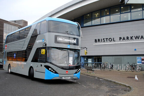
South Gloucestershire Council is consulting on a radical ‘masterplan’ for the transformation of Bristol Parkway Station that would see it change from simply being a place to access the rail network to a “valued destination” that incorporates work places, cafes, restaurants, homes, community facilities and parks.
The objective of the masterplan is to create a new vision for the sustainable regeneration of the station as a gateway to the Bristol North Fringe, South Gloucestershire and wider region.
The vision is centred around a remodelled east-west linear ‘street’ that would run parallel to the railway tracks, avoiding the current tortuous route around the multi-storey car park (constructed 2013/14).
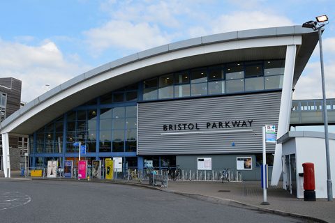
The current station building would be demolished, along with the decked parking area alongside the railway, with a new station and public square being built further to the east.
Removal of the decked parking area is justified by figures which show that car parking utilisation at the station during weekdays in 2018/19 (i.e. pre-Covid) was just 50 percent of the available capacity.
The Network Rail training centre at the eastern end of the site would also be demolished to make way for new development.

View a hi-res version of the above image (on Dropbox).
The passenger footbridge of the current station would be retained, and it would be extended to provide pedestrian access from a point south of the railway, near the mini-roundabout at the junction of Church Road, Hambrook Lane and Westfield Lane.
A ‘movement plan’ (below) shows a new ‘walking, cycling and wheeling’ route connecting Brins Close (a cul-de-sac off North Road in Stoke Gifford ‘village’) to the new station building.

View a hi-res version of the above image (on Dropbox).
Access from Brierly Furlong would be improved through the creation of a new subway under the railway, close to the existing road underbridge, for use by pedestrians and cyclists.
The movement plan appears to show pedestrian and cyclist provision being maintained on the west side of the existing road underbridge. No mention is made of the possibility of upgrading the narrow, partially arched underbridge, meaning that vehicle bridge strikes will still be likely to happen from time to time.
The current ground-level car parking area between St Michael’s Church and the station building would be converted to green space (provisionally named ‘St Michael’s Green’), with the option to include some community buildings.
A second area of formalised green space would be created in the form of a new ‘Stoke Gifford Park’ on the current scrubland between the Trust Grounds (off North Road) and the eastern end of the linear street, beyond the new station building.

In the heart of the scheme, leading up to and around the station square, a mix of uses such
as restaurants, cafes, commercial space, homes and leisure is suggested to create a vibrant street.
Moving further east, the focus is on employment where a degree of other uses such as cafes, gyms and possibly other services such as creche are suggested, to provide for “life beyond the desk”.
Planning permission already exists for a proposed large office development known as ‘The Approach’ on the old brickworks site on Hunts Ground Road (opposite the Parkway North park & ride site).
The park & ride site itself would be retained, or alternatively be re-designated for employment use.
Living station
.")
The proposals align with Network Rail’s ‘living station’ concept, in which the role of a railway station station is changing from a place where the only purpose is to access the rail network to bustling places which serve the wider community and deliver outstanding passenger experience.
At the heart of the scheme would be a new and modern station building, set within a new station square that will “transform people’s experience of public transport and active travel, and create a memorable sense of arrival and departure”. Buses, safe cycle storage, disabled parking and taxis will be located around the square.
The station would also enable new and improved access rail side, with a potential access at level to a ‘London’ arrivals platform and a new eastern bridge access to the platforms, thus enabling a full circuit for passengers between both extremes of the platforms.
Timescale & phasing
The masterplan sets out a future vision and blueprint for change at Bristol Parkway “over the next 10 years and beyond”.
The changes would not be delivered in one phase. It is likely to take “a number of years” for the scheme to be realised in full as different parts of the site are created or changed in line with the availability of various funding streams.
Phase 1
During the early phase, the land to the east and west may come forward first. This would
leave the station and the current interchange (bus stops, taxi rank and multi storey car parks)
functioning as they currently do. The station would remain unchanged and any works to
the tracks such as a new over bridge would not have started. New buildings and parks in these areas to the east and west will begin the process of transforming Bristol Parkway including the delivery of St. Michael’s Green.
Early stages of ecological enhancement may take place in the new Stoke Gifford Park area and the Brierly Furlong underpass would be delivered.
Phase 2
The process of creating a new station and interchange begins. The current station and interchange remain in use but to the east a new site compound would be created. The decked parking area here and the current Network Rail training centre would be removed and a new home found for the latter.
Phase 3
The new station, station square and interchange open. New buildings will contribute to the sense of destination around the station by catering for daily needs and providing new bases for business and possibly homes. The site of the existing station is decommissioned but the current overbridge is extended to create better access from the north to south. Bristol Parkway is now viewed as a major gateway to the north of Bristol.
Phase 4
The ‘Street’ is finally completed, linking east to west through the site for walking, wheeling and cycling and buses. This final section will be lined by new buildings to create the sense of a local high street. The potential transformation of the Parkway North park & ride site could take place if an alternate location is found. The existing multi-storey car park could also be redeveloped if travel patterns change and the amount of parking required is reduced.
Alternative parking for the station would be provided in a multi-storey car park to the east of the new station building.
Partners & funding
The masterplan has been initiated by South Gloucestershire Council and Network Rail, with support of West of England Combined Authority. Design and technical support is being provided by Arup and Jacobs. Great Western Railway (GWR), which manages the station, is a key partner and part of the masterplan process.
Possible funding sources include public sector grants or loans, value capture mechanisms (from increased land values around the station), station-related commercialisation revenues and user charges (ticket sales).
Project delivery
The masterplan lists several potential approaches to delivering the redevelopment of Bristol Parkway. Likely options include:
- Network Rail (likely in partnership with GWR)
- Private Finance Initiative (or similar)
- Public sector-led delivery (with SGC as lead developer)
It is possible that the redevelopment project may adopt a hybrid approach that involves a combination of several of the above models.
Have your say
To provide feedback on the draft masterplan, visit South Gloucestershire Council’s consultation page, Bristol Parkway Station and Surrounds Masterplan, where the full set of documents may be viewed along with a comprehensive FAQ (frequently asked questions) compilation.
The council asks that you respond by completing its online survey after reading the Bristol Parkway Masterplan Stage 3 Report [PDF; 32.2MB].
The consultation closes at midnight on Sunday 14th August 2022.
Drop-in information events were held in Stoke Gifford on 14th and 27th July. You can now view the information boards [PDF; 16.8MB] that were displayed at these events.
Related links
- Bristol Parkway Masterplan (Friends of Suburban Bristol Railways)
- The future of Bristol Parkway could be without cars (Bristol 24/7)
