
Anyone using the Stoke Gifford By-Pass, Hambrook Lane or Old Gloucester Road in recent months will have noticed a marked increase in construction activity as housing developers have begun creating access points into areas designated for the building of more than 1,600 new homes.
Outline planning permission for the bulk of the East of Harry Stoke (EoHS) New Neighbourhood was granted to Crest Nicholson in 2018. Separate applications were approved for land north and south of the railway, with 327 homes earmarked on the land to the north and 1,290 on land to the south.

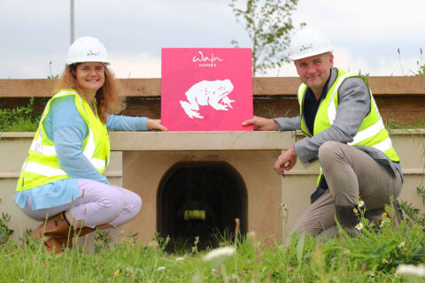
Crest Nicholson has since sold its parcel of land north of the railway to Wainhomes, who have recently secured full planning permission to build 150 of the 327 homes. They are marketing the site under the name ‘Mulgrove Farm Village’.
The remainder of the land north of the railway remains in the ownership of South Gloucestershire Council which is understood to be in negotiations with another party to bring forward the remaining 177 homes.
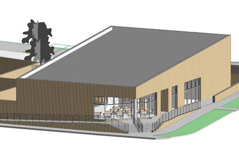
A primary school and nursery are also earmarked for the site.
The two planned vehicular access points into the land north of the railway have now been created, one off Parkway North Roundabout (from where the first newly built homes can now just be glanced) and another off Old Gloucester Road, 90m south of its junction with Winterbourne Road.

South of the railway
Recent activity on the land south of the railway has centred around an area just south of the junction of the Stoke Gifford By-Pass with Hambrook Lane, where a new traffic light-controlled crossroads has been constructed, giving access into the Crest Nicholson land either side of the main road.
Hambrook Lane itself was closed either side of the by-pass during this work. It has now reopened on the west side, but is ‘left in, left out’ only (in accordance with the approved EoHS masterplan).
Travelling from the east, the final section of Hambrook Lane is now closed, so there is no longer access to the by-pass. There will eventually be junctions on this section of Hambrook Lane allowing access into the new Crest Nicholson housing on either side of the road, but still no ‘straight-on’ access to the by-pass for motor vehicles.

The new crossroads on the by-pass has created access into a parcel of Crest Nicholson land on the west side of the main road where the developer plans to build its first 144 new homes south of the railway. Full planning permission was granted last month, and ecologists have been observed working on the site in the past few weeks, suggesting that building could soon get under way. This site is variously named ‘Lower Hambrook’ or ‘Highbrook View’ in the planning documents.
East of the by-pass
Infrastructure work is proceeding on the east side of the by-pass in the same vicinity, in accordance with the outline planning permission. Reserved matters (detailed) planning applications for housing on this side of the main road are yet to be brought forward by Crest Nicholson.

Also on this side of the by-pass, IKEA-backed housing developer BoKlok has submitted a full planning application to build 50 new homes at Hoodlands Farm – land that is not covered by the outline permission previously secured by Crest Nicholson.
Elsewhere on the land south of the railway, one of the two high-voltage electricity transmission lines that cross the area has now been ‘undergrounded’ around the perimeter of the site.
• View a hi-res version of the East of Harry Stoke New Neighbourhood: Illustrative Masterplan on Facebook, Dropbox or issuu.com
Planning applications
Land North of the Railway
Planning ref: PT16/4928/O
(Hybrid planning application)
Status: Approved & S106 signed
Full permission for 150 new homes
Outline permission for 177 new homes, primary school and nursery
Planning ref: P20/03681/F
Full permission for 150 new homes
Status: Approved & S106 signed
Developer: Wainhomes
Site name: Mulgrove Farm Village
Hoodlands Farm
Planning ref: P21/05128/F
Status: Pending
Full permission for 50 new homes
Developer: BoKlok
Land South of the Railway
Planning ref: PT16/4782/O
Outline permission for a mixed-use development including 1,290 new homes, a local centre, community facilities, landscaping and open space, and detailed access junctions
Status: Approved & S106 signed
Planning ref: P20/17975/RM
Reserved matters (detailed) permission for 144 new homes
Status: Approved & S106 signed
Developer: Crest Nicholson
Site name: Lower Hambrook
This article originally appeared in the October 2021 issue of the Stoke Gifford Journal magazine (on pages 16 & 17). The magazine is delivered FREE, nine times a year, to over 5,000 homes in Stoke Gifford, Little Stoke and Harry Stoke. Phone 01454 300 400 to enquire about advertising or leaflet insertion.
